|
 South Korea favors short-range missiles
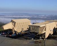
Seoul (UPI) Oct 28, 2010 South Korea said it favors a joint U.S-Korean missile defense system rather than the United States-led plan involving the purchase of longer range missiles. South Korea's anti-missile system, under the Korea Air Missile Defense program, is designed to protect the south from short-range missiles fired by North Korea while the U.S. system uses missiles to protect against medium- and long-range ballistic missile threats. "South Korea and the U.S. will discuss intelligence sharing and operat ... read more |
. |
|
|
Free Space, Earth, Energy And Military Newsletters - Delivered Daily |
| . | . |
|
Contract Awarded For New Battlefield Radar Requirement ThalesRaytheonSystems has been selected as one of two companies to study the viability of an Omni-Directional Weapon Locating (OWL) radar for the U.S. Army. ThalesRaytheonSystems will develop ... more | .. |
 CASSIDIAN Protects German Navy Ships With Latest ID Systems Cassidian, the recently re-named defence and security pillar of EADS, protects German Navy ships with identification systems to avoid confrontations with unknown aircraft. With the equipping of the ... more | .. |
 Offshore Wind A Mixed Bag Offshore wind power offers a feasible way for Maryland to help meet its renewable energy goals, but presents some economic and political hurdles, concludes a new study by the University of Maryland ... more | .. |
 First MEADS Intra-Fire Unit Communications Hardware Delivered Lockheed Martin recently delivered the first two intra-fire unit communications hardware components for the tri-national Medium Extended Air Defense System (MEADS). The two Message Routing Sub ... more | .. |
 New Coherent Doppler Radar For Patrol Vessels And Small Combatants Northrop Grumman has introduced a new family of X-Band Coherent Radar (XBCR) systems designed primarily for offshore patrol vessels (OPV) and other smaller combat ship platforms. The SeaGuard ... more |
|
Free Space, Earth, Energy And Military Newsletters - Delivered Daily |
| .. |
 Greenbelt MD (SPX) Oct 27, 2010
Scientists returned this week to the Southern Hemisphere where NASA's Operation IceBridge mission is set to begin its second year of airborne surveys over Antarctica. The mission monitors the region's changing sea ice, ice sheets and glaciers. Researchers will make flights from Punta Arenas, Chile, on NASA's DC-8, a 157-foot airborne laboratory equipped with a suite of seven instruments. T ... more  London UK (SPX) Oct 27, 2010
Sea levels around the Falkland Islands in the South Atlantic have risen since the mid nineteenth century and the rate of sea-level rise has accelerated over recent decades, according to newly published research. The findings are as expected under global warming and consistent with observations elsewhere around the globe. "We have been fortunate in being able to compare modern sea-level mea ... more  Greenbelt MD (SPX) Oct 26, 2010
NASA satellites have watched as Richard went through a couple of life-transitions over the weekend. Richard developed into a tropical storm last week, intensified into a hurricane and made landfall in Belize and is now a tropical depression, poised to enter western Gulf of Mexico. Richard formed in the Caribbean Sea on 20 October 2010. The Tropical Rainfall Measuring Mission (TRMM) satelli ... more |
.. |
 Somalia Islamists splinter in major rift  Australia Super Hornet program moves ahead  Instant online solar energy quotes Solar Energy Solutions from ABC Solar |
.. |
 Drone Radar Over Alaska and Wyoming Points Way to Buried Ice on Mars
 NISAR Radar Satellite Tracks Mexico City Ground Sinking at Over Half an Inch Per Month
 New hunt for flight MH370 ends with no clues to 12-year mystery
 |
|
Free Space, Earth, Energy And Military Newsletters - Delivered Daily |

|
. |
 TanDEM-X And TerraSAR-X Imaging Etna While Flying In Formation
Bonn, Germany (SPX) Oct 21, 2010 The TanDEM-X and TerraSAR-X satellite pair have acquired their first image of Earth's surface, synchronised to the microsecond, while flying over Mount Etna in Italy. Scientists at the German Aerospace Center have used the data to create a three-dimensional digital elevation model with an unprecedented elevation accuracy down to two metres. The image, taken while the satellites were flying just 350 metres apart, is the first in the world to be made by satellites flying in such a close formation. ... read more |
| The contents herein, unless otherwise known to be public domain, are Copyright 1995-2010 - SpaceDaily. AFP and UPI Wire Stories are copyright Agence France-Presse and United Press International. ESA Portal Reports are copyright European Space Agency. All NASA sourced material is public domain. Additional copyrights may apply in whole or part to other bona fide parties. Advertising does not imply endorsement, agreement or approval of any opinions, statements or information provided by SpaceDaily on any web page published or hosted by SpaceDaily. Privacy statement |
|
Free Space, Earth, Energy And Military Newsletters - Delivered Daily |
| Previous Issues | Oct 29 | Oct 28 | Oct 27 | Oct 26 | Oct 25 |